NEHODIV
49.4167 N
13.5500
E
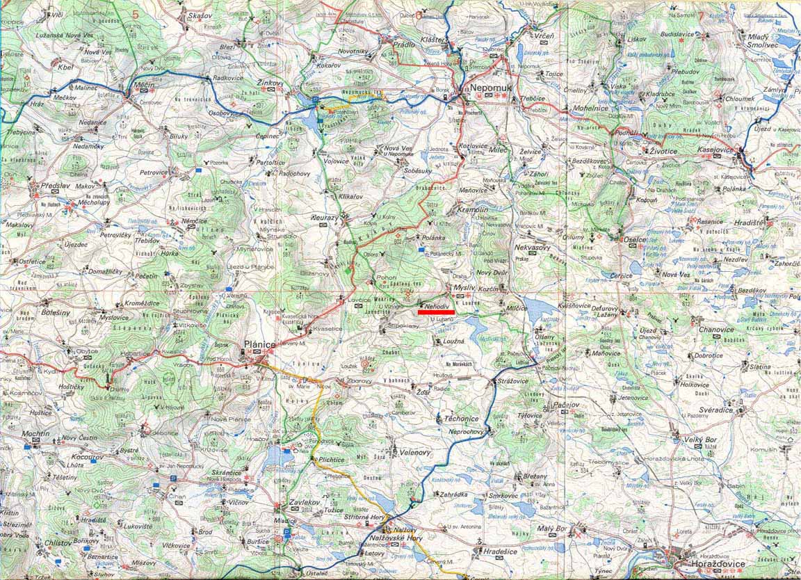
Nehodiv is located about 7 km (5 miles) south southwest of Nepomuk in the foothills of the Baviarian mountains. The West German border lies over the mountains (which are as high as 1100 meters or 3,000 feet) about 65 km (40 miles) southwest of Nehodiv, and Prague lies about 100 km (60 miles) northeast of Nehodiv over mostly flat terrain. In the immediate area of Nehodiv there is a mountaintop about 500 meters northwest of the village that is about 100 meters (300 feet) higher than the village itself, to the southeast about 1500 meters is a small lake ("Myslivsky ryb") whose elevation is nearly 100 meters below the village. The village is thus on the hillside of the valley containing the lake. The valley floor runs roughly southwest-northeast at an elevation of 600 meters. There is a small church (indicated as a "chapel") in Nehodiv (and in each of the surrounding villages as well) with the nearest large churches in Nepomuk and Techonice (4 km south). The nearest post offices are in Mysliv (1 km east) and Lovcice ( 3 km west). Other services (gas stations, etc.) are located in Nepomuk and Planice (6 km wsw). The nearest "city" is Klatovy (15 km west).